Airport Information

Webster City Municipal Airport

       Location

  • Identifier: EBSInsert picture here
  • Latitude: 42-26-11.0887N  I  42-26.184812N
  • Longitude: 093-52-08.2813W  I  093-52.138022W
  • Elevation: 1121 ft.
  • From city: 3 miles SW of Webster City, IA
  • Time Zone: UTC -6 (-5 during Daylight Savings Time)
  • Zip Code: 50595

       Operations

  • FBO: Storm Flying Service
  • Managers: Steve & Mike Luedtke
  • Hours attended: 0700-Dusk
  • Beacon: Yes
  • Lights: Pilot-Controlled Lighting
  • Sectional Chart: OMAHA
   

 Insert picture here

   Communicatio​​​​​​​ns

  • ​​​​​​​CTAF/UNICOM: 1​​​​​​​22.8
  • ​​​​​​​Lights: 122.8
  • Weather: 127.82 (515-832-2794)
  • Minneapolis Center APP/DEP CON: 134.0

   ​​​​​​​

   Services​​​​​​​

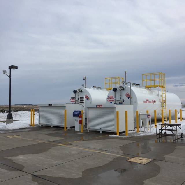
  • Fuel: 100LL & Jet A - Full service or 24-hr self-service
  • Parking: hangars and tie-downs
  • Courtesy car: available
  • Maintenance: Hinman Aviation​​​​​​​
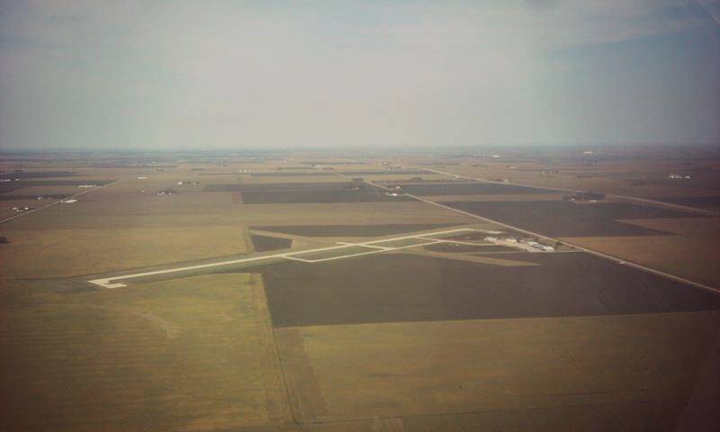


       Runways

RWY Surface Length Width RWY Lights App Lights VGSI
05/23* Grass 2663 90 NONE NONE NONE
14/32 Concrete 3851 75 MIRL REIL/REIL P2L/P2L
​​​​​​​

          *Runway 05/23 closed November-April


       Frequencies and Phone Numbers

  • Webster City Unicom (CTAF):  122.8 MHz
  • Pilot-Controlled Lighting:          122.8 MHz
  • VOR (FOD):                             113.5 MHz
  • Minneapolis Center:                 134.0 MHz
  • FSS:                                         122.3 MHz (800-992-7433)
  • AWOS:                                     127.82 MHz (515-832-2794)


  • Office Phone:                            515-832-3723
  • Local Law Enforcement:           515-832-9500 (or 911 in emergency)